The Sketch Map Tool is used all around the world in many different situations. Each of the case studies explores one project in detail.
Sketch Map Tool Use-Case in EVCA Context
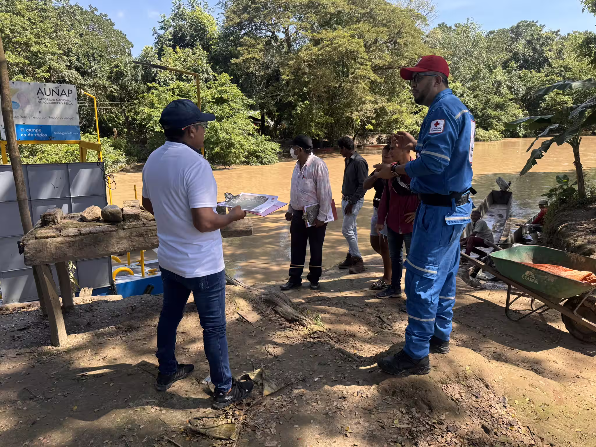
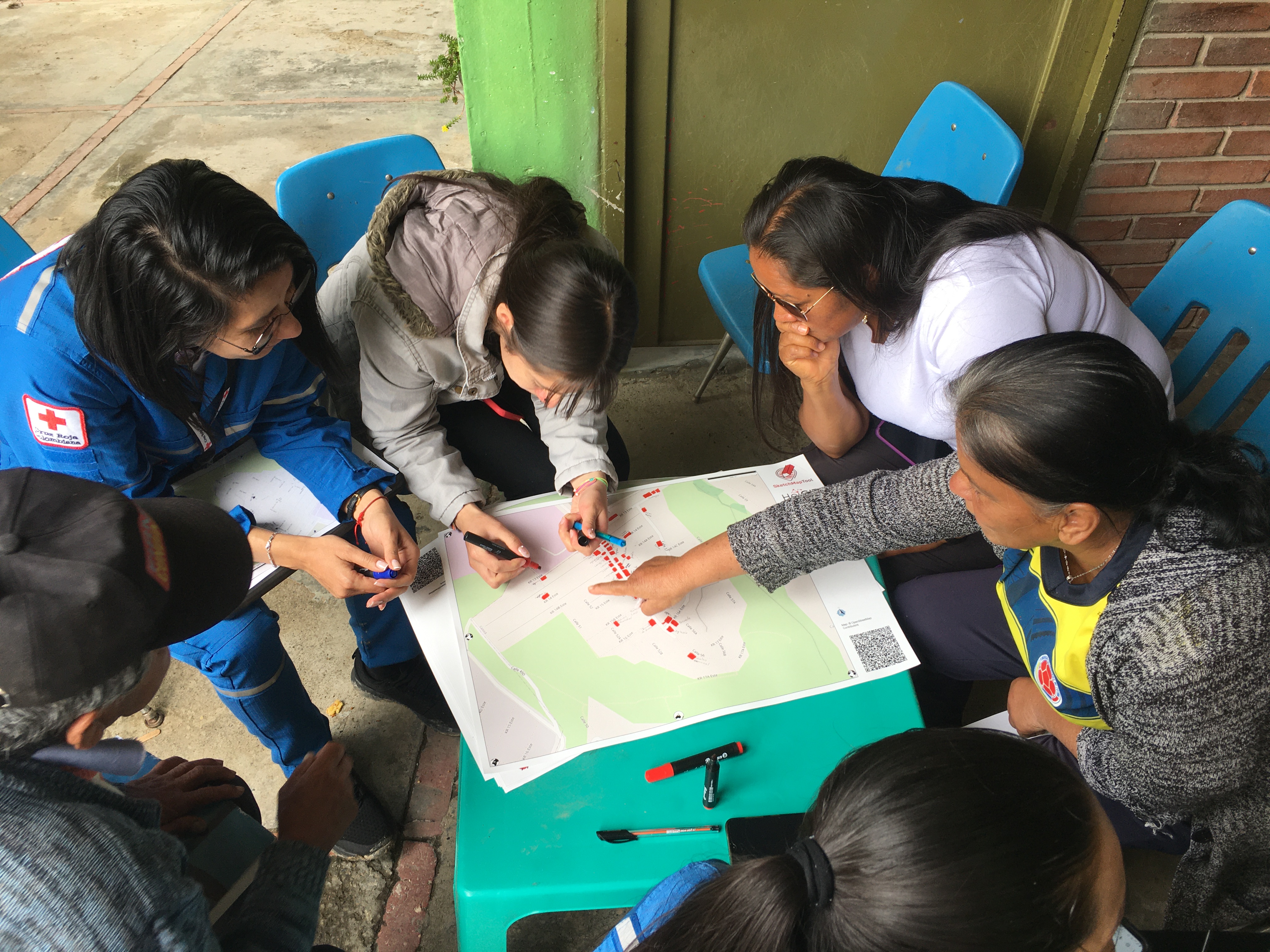
The Colombian Red Cross's Disaster Risk Management (DRM) CRC has continued to implement the Sketch Map Tool in their workflows for conducting EVCAs within the framework of the ongoing project „Providing humanitarian assistance to vulnerable and affected populations in Colombia“.
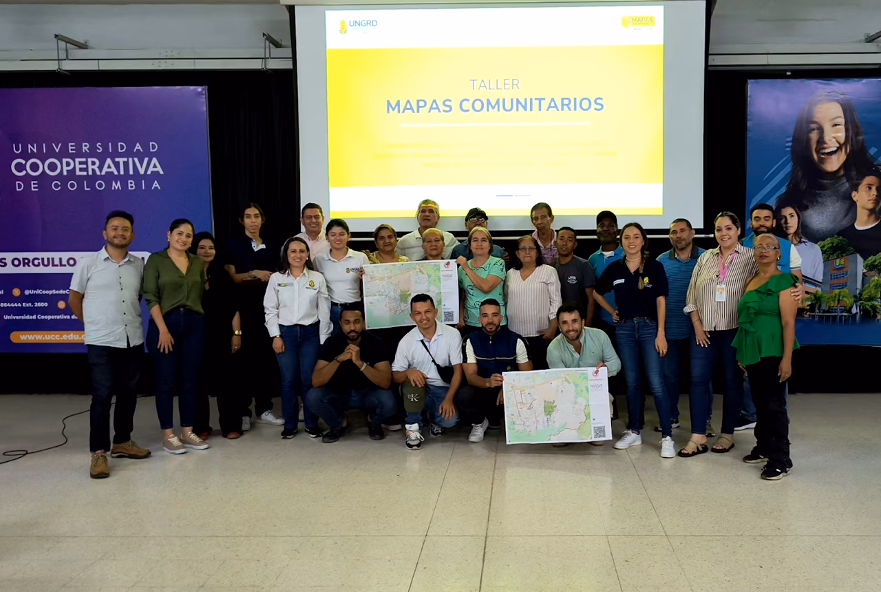
Strengthening national risk management in Colombia
Colombia's National Unit for Disaster Risk Management used the Sketch Map Tool in their Mapas Comunitarios project to integrate technical and local knowledge, thereby strengthening grassroots capacities for territorial risk reduction.
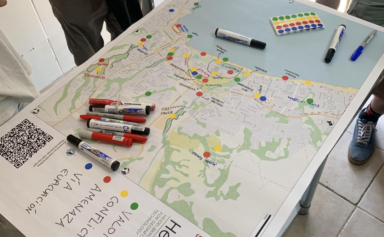
Participatory Mapping for Disaster Risk Reduction in Cartagena, Chile
In the complex multi-hazard context of Cartagena, the Sketch Map Tool empowered the community to actively document their local perspectives on risks like tsunamis and landslides, generating the inclusive geographic information essential for effective disaster risk reduction.
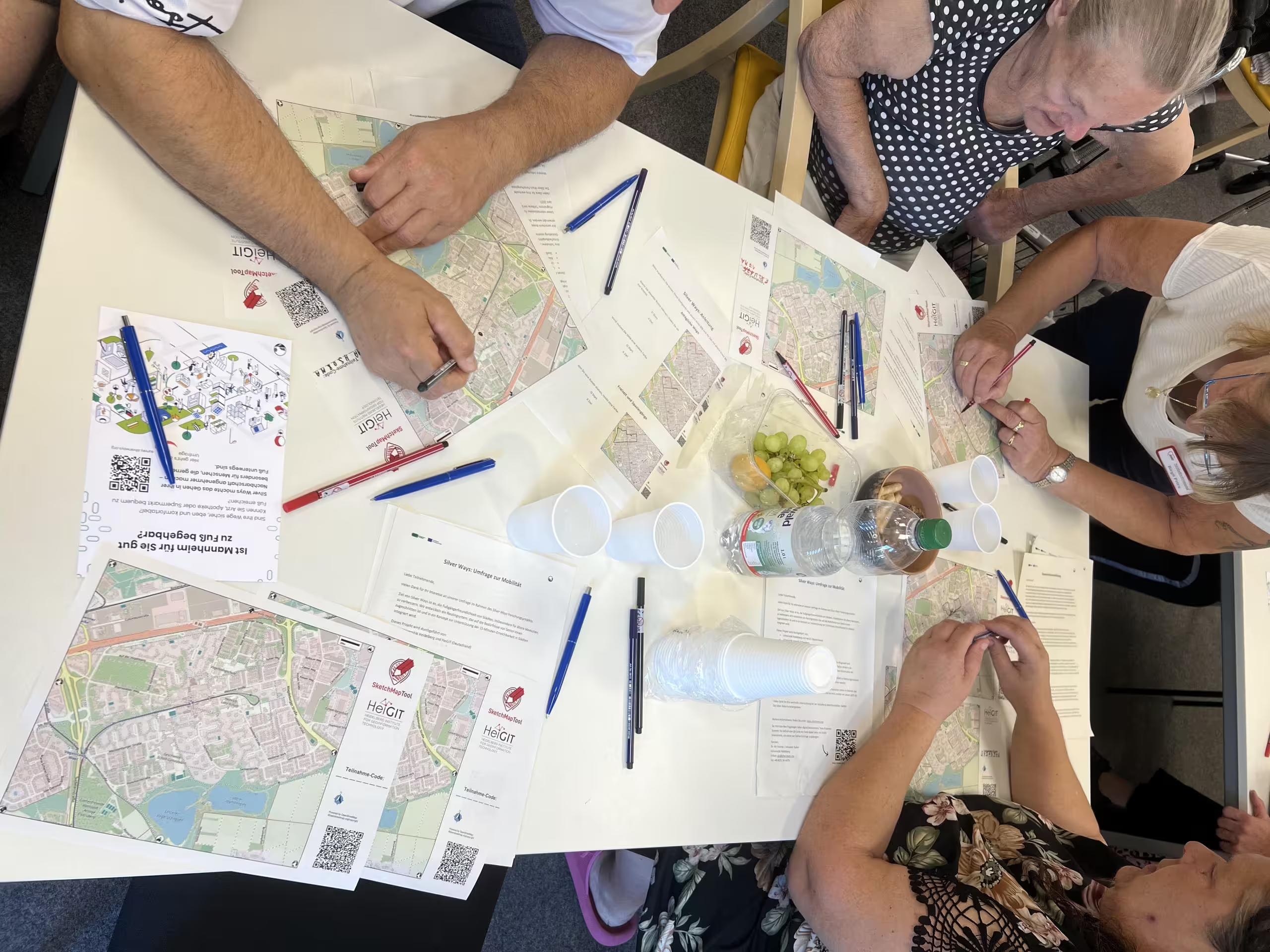
The Sketch Map Tool facilitated the participatory mapping of age-friendly walking routes, capturing critical data on personal preferences and obstacles to inform a tailored routing system and the development of a 15-Minute Neighborhood Index for older adults.
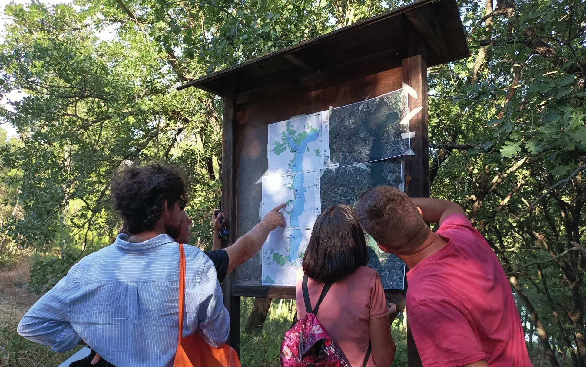
The Sketch Map Tool was used as part of a PhD research to study the local community´s perception of the changing territory around an artificial dam in a rural area in southern Italy.
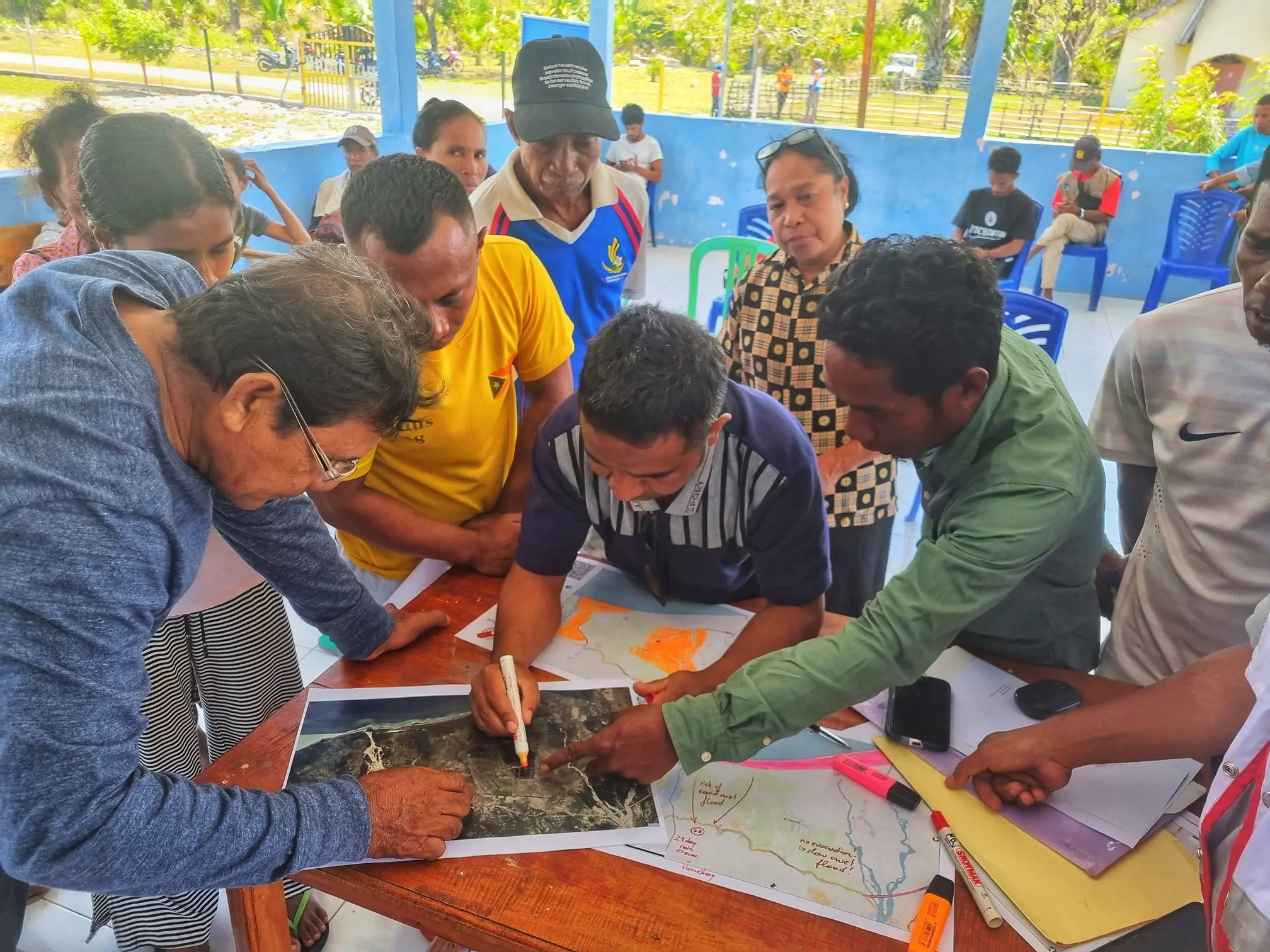
The Anticipatory Action team of RCCC (Red Cross and Red Crescent Movement) conducted a pilot project in Timor Leste to implement anticipatory mapping using OpenStreetMap.
Digitalizing Paper-Based Community mapping in the EVCA
Together with the Colombian Red Cross the usage of the Sketch Map Tool in EVCA (Enhanced Vulnerability and Capacity Assessments) and the benefits of digitization of paper-based community mapping was explored.
In a seminar on GIS for Disaster Risk Reduction at Heidelberg University, Geography students explored local perceptions of urban heat using the Sketch Map Tool and KoboToolbox for participatory mapping
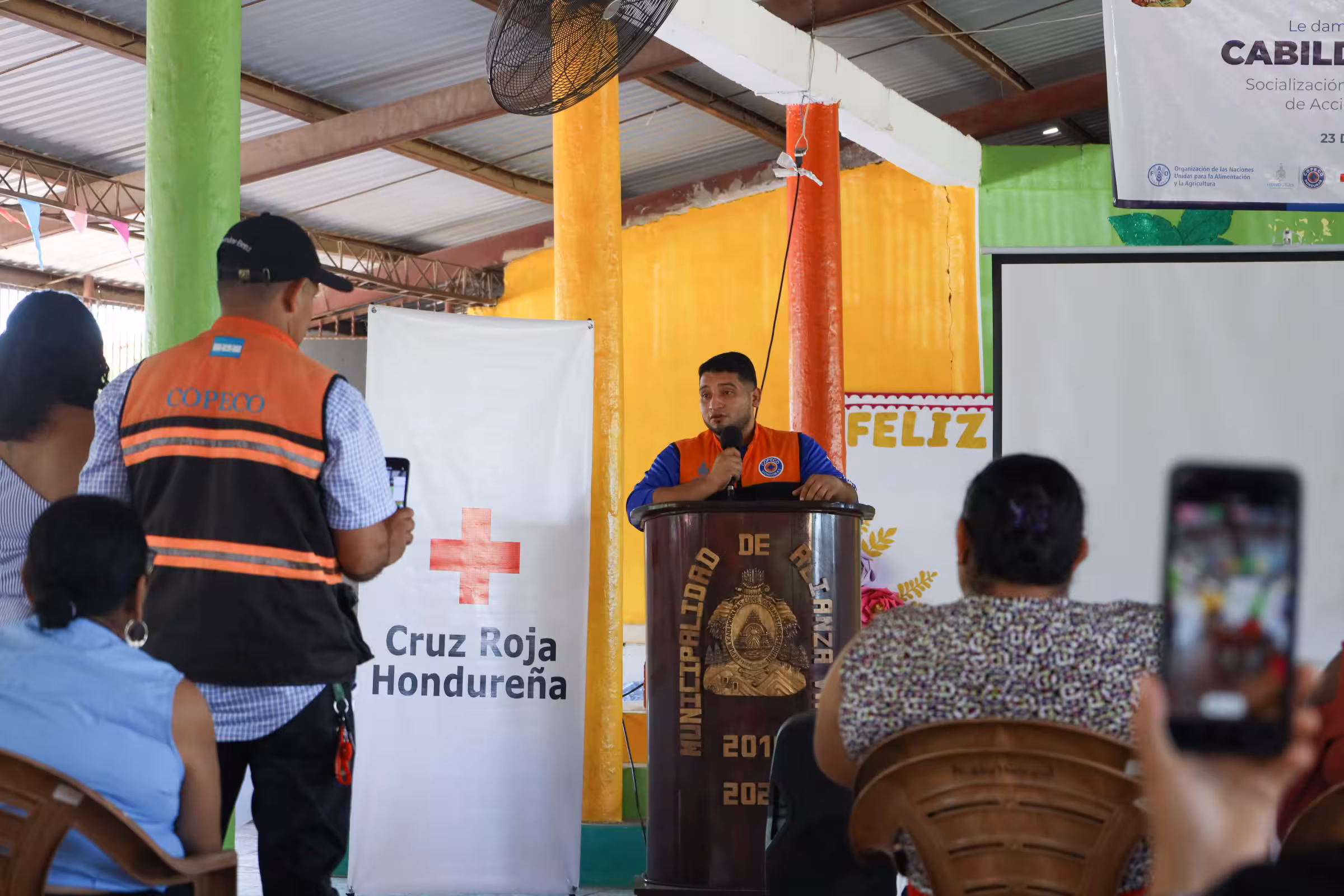
The Sketch Map Tool was used in a joint effort between the
Honduran Red Cross and the municipal government to update the
municipal response plan and develop an annex focused on
anticipatory actions.
We're looking to add more real-life use cases. Do you use the Sketch Map Tool? We'd love to hear your story! Please get in touch with us:
sketch-map-tool@heigit.org