 Klipper, S (2024). DRR in Action Case Study: Digitalizing Paper-Based Community mapping in the EVCA.
https://preparecenter.org/resource/digitalizing-paper-based-community-mapping-in-the-evca/
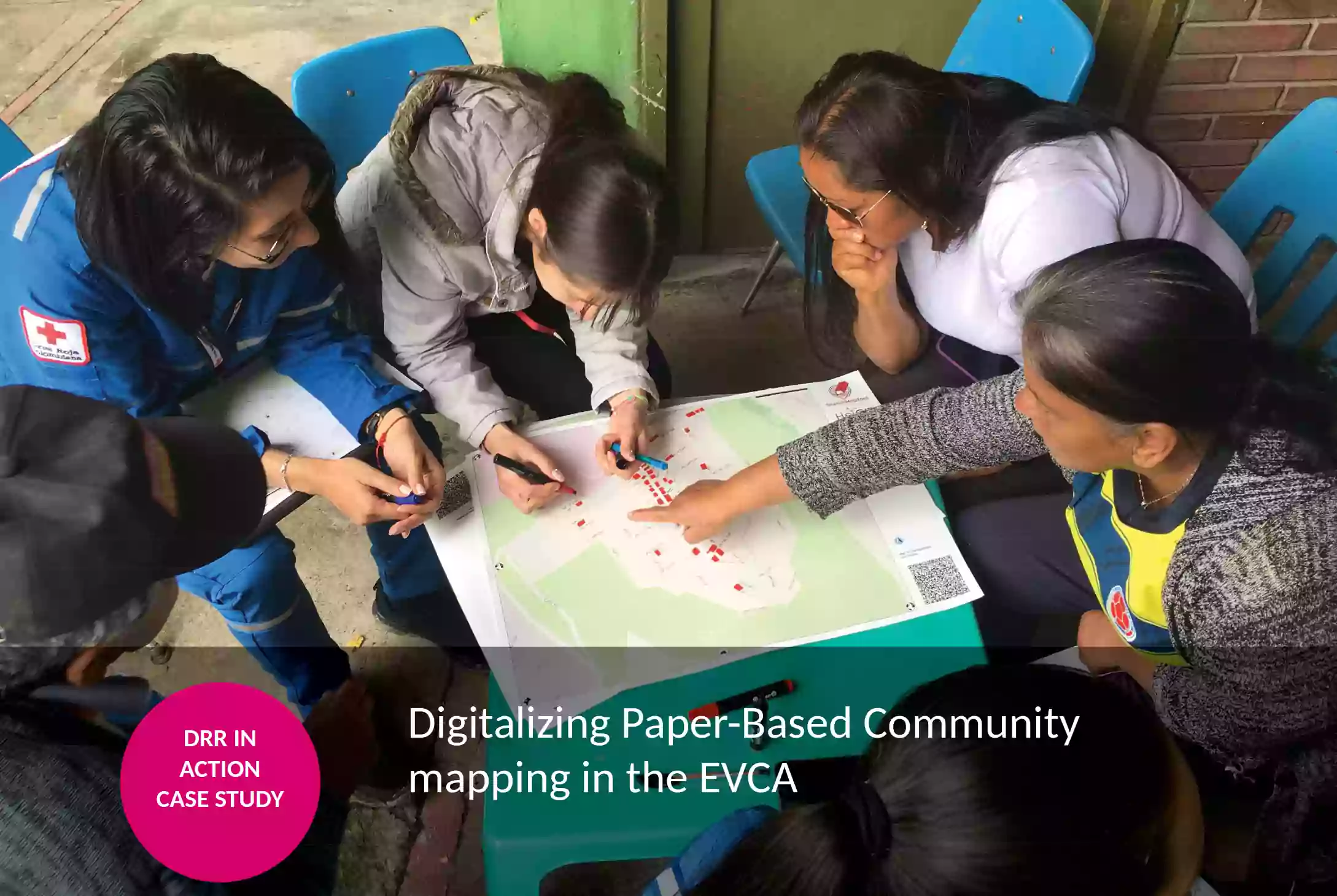
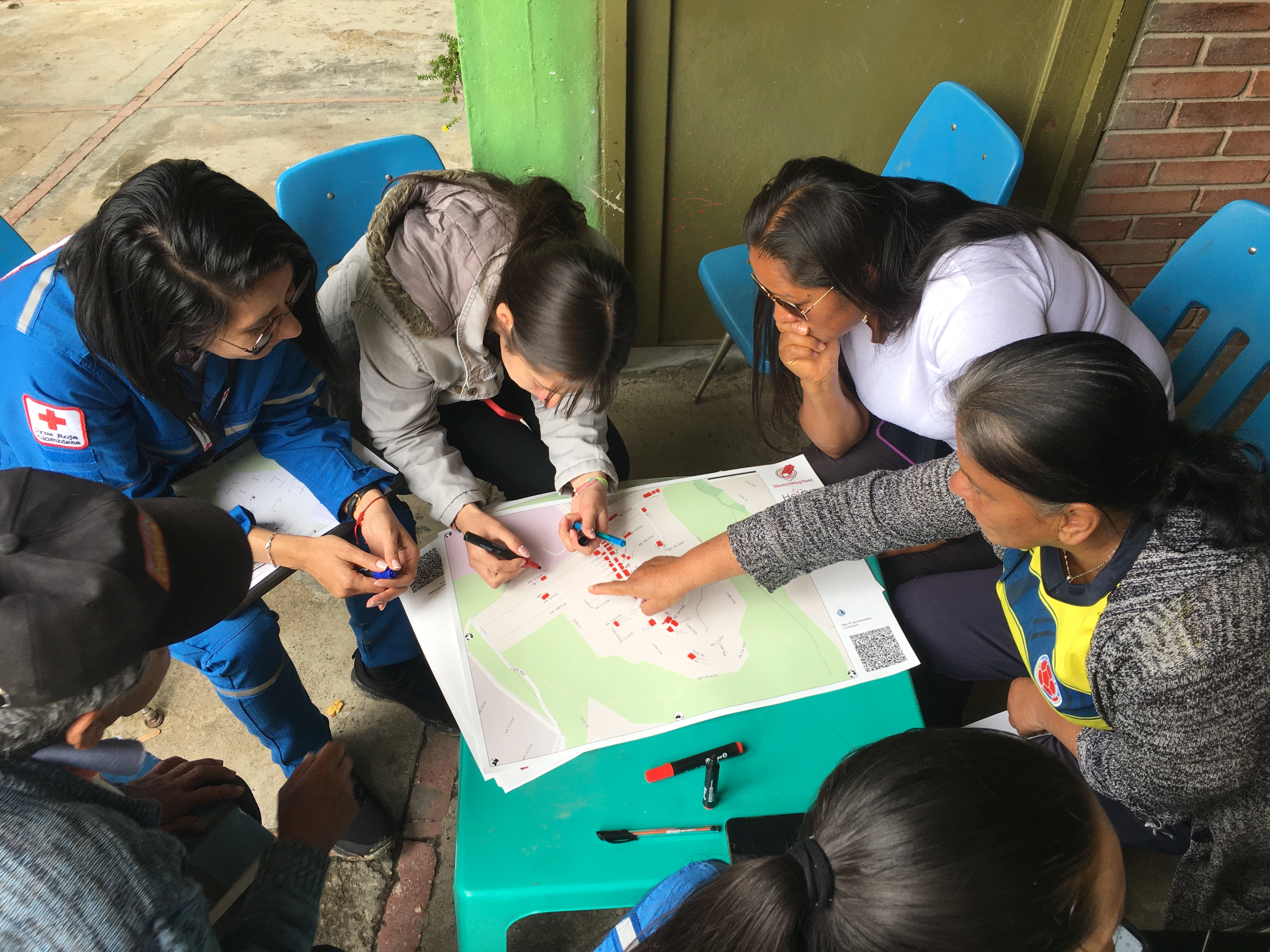
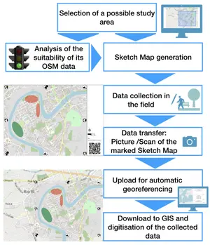
The Sketch Map Tool is an easy-to-use tool for participatory mapping through offline collection, digitization, and georeferencing of local data. The low-tech solution is designed to simplify the collection and analysis of local spatial knowledge and perceptions with pens and paper maps, the so-called Sketch Maps. The Sketch Map Tool is an open-source web application. It facilitates the creation, usage and the digitization of paper-based maps with OpenStreetMap and satellite data.
The Sketch Map Tool supports users in all the important steps of offline participatory mapping, from creating paper maps to digitizing them.
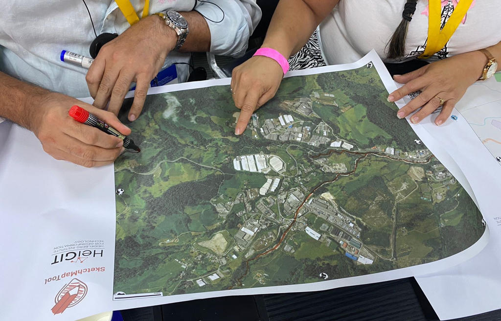
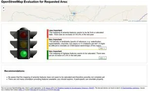
Define your area of interest and your base map (OpenStreetMap (OSM), satellite imagery by ESRI or OpenAerialMap imagery (OAM)), look at the OSM Map Quality check provided by HeiGIT ohsome quality API and export the map as a PDF.
Offline data collection with local communities, either individually or as a group activity. Participants mark their local knowledge directly onto printed Sketch Maps with pens.
Scan or photograph your marked Sketch Maps, upload the images to the Sketch Map Tool and download collected markings (geojson and geotiff). The tool georeferences the Sketch Maps and detects the markings employing a fusion of computer vision algorithms and novel AI models. The results can then be used for further analysis in Geographic Information System software.

The Sketch Map Tool project has been developed in close cooperation between the HeiGIT and the GIScience Research Group from Heidelberg University with the generous contributions of several sponsors and support by partner organizations.
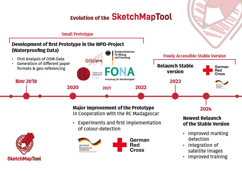
The development of the Sketch Map Tool began in 2018 as an idea and simple prototype in the Waterproofing Data project (funded by the Federal Ministry of Education and Research - BMBF). In 2021, this initial prototype received a major update, including an improved user interface and the first implementation of color detection (using computer vision)
Since then, the tool has been tested by humanitarian organizations worldwide, including in Germany, Chile, Colombia, Brazil, Mozambique, Madagascar, Honduras, Ghana, Kenya, and Sudan. Following its 2023 relaunch as a stable version, the Sketch Map Tool is now an official part of the HeiGIT tool suite.
The tool is continuously evolving to meet the needs of humanitarian actors:
The continuous development and adaptation of the Sketch Map Tool for humanitarian use has been made possible through a strong collaboration with the German Red Cross (GRC) and significant financial support from the German Federal Foreign Office within the framework of the "Global Project II." This project contributes to reducing the negative consequences of disasters for affected populations by extending strategic humanitarian topics and innovative approaches. Core maintenance of the tool and regular updates to the machine learning models are ensured by core funding from the Klaus Tschira Foundation (KTS).
The focus of the relaunch in 2024, once again funded within the framework of the Globalprojekt II, was the implementation of satellite images as a base map and the overall improvement of color detection, especially on satellite images. Additionally, general software stability was further ensured, and customized training materials designed to make the tool more accessible to end-users with different knowledge levels.
We envision a world in which communities worldwide are empowered to collect, communicate, and utilize local spatial information and knowledge effectively through an open-source, low-tech, participatory mapping solution. This solution bridges paper-based data collection with digital analysis and storage, aiming for collaborative visualization and analysis of current and past conditions and perceptions. The goal is to raise awareness and co-create transformative change in areas impacted by sustainability challenges.
If you have questions or would like to provide feedback, please reach out to the project team.
Detailed step-by-step instructions about how to use the tool and FAQs can be found on the Help page.
The code of the Sketch Map Tool is released on GitHub.
On the IFRC Network GIS Training Platform, developed by HeiGIT gGmbH, there are five exercises and trainers` instructions available to learn how to use the Sketch Map Tool and handle the results.
If you are interested in learning more about the concept and development of the Sketch Map Tool, consider watching the video of the lightning talk “OpenStreetMap Sketch Map Tool - The Future of OpenStreetMap Field Papers” at GeOnG 2020.
Additionally, Episode 7 "Mapping in der Humanitären Hilfe” of the podcast CHAtroom (in German) offers further insights. In this episode from the Center for Humanitarian Action (CHA), Dr. Natascha Bing (GRC) and Dr. Carolin Klonner (GIScience Heidelberg) discuss the importance of maps in disaster management and explore how the Sketch Map Tool can be utilized by humanitarian organisations.
The following scientific articles have been published about the Sketch Map Tool:
Klipper, S (2024). DRR in Action Case Study: Digitalizing Paper-Based Community mapping in the EVCA.
 Klonner, C., Hartmann, M., Dischl, R., Djami, L., Anderson, L., Raifer, M., Lima-Silva, F., Degrossi, L. C., Zipf, A., de Albuquerque, J. P. (2021): The Sketch Map Tool Facilitates the Assessment of OpenStreetMap Data for Participatory Mapping, 10(3): 130. ISPRS International Journal of Geo-Information. 10:130.
 Klonner, C. & Blessing, L. (2019). Gathering Local Knowledge for Disaster Risk Reduction: The Use of Sketch Maps in Group Discussions. In: Proceedings of the ISCRAM 2019 Conference. Valencia, Spain, pp. 1397–1398.
 Klonner, C., Hartmann, M., Djami, L., Zipf, A. (2019). Ohsome OpenStreetMap Data Evaluation: Fitness of Field Papers for Participatory Mapping. In: Proceedings of the Academic Track at the State of the Map 2019. Heidelberg, Germany, pp. 35-36
 Klonner, C., Usón, T. J., Aeschbach, N., Höfle, B. (2021). Participatory Mapping and Visualization of Local Knowledge: An Example from Eberbach, Germany. In: International Journal of Disaster Risk.
HeiGIT gGmbH
Heidelberg, Germany
Email: sketch-map-tool@heigit.org
Web: heigit.org